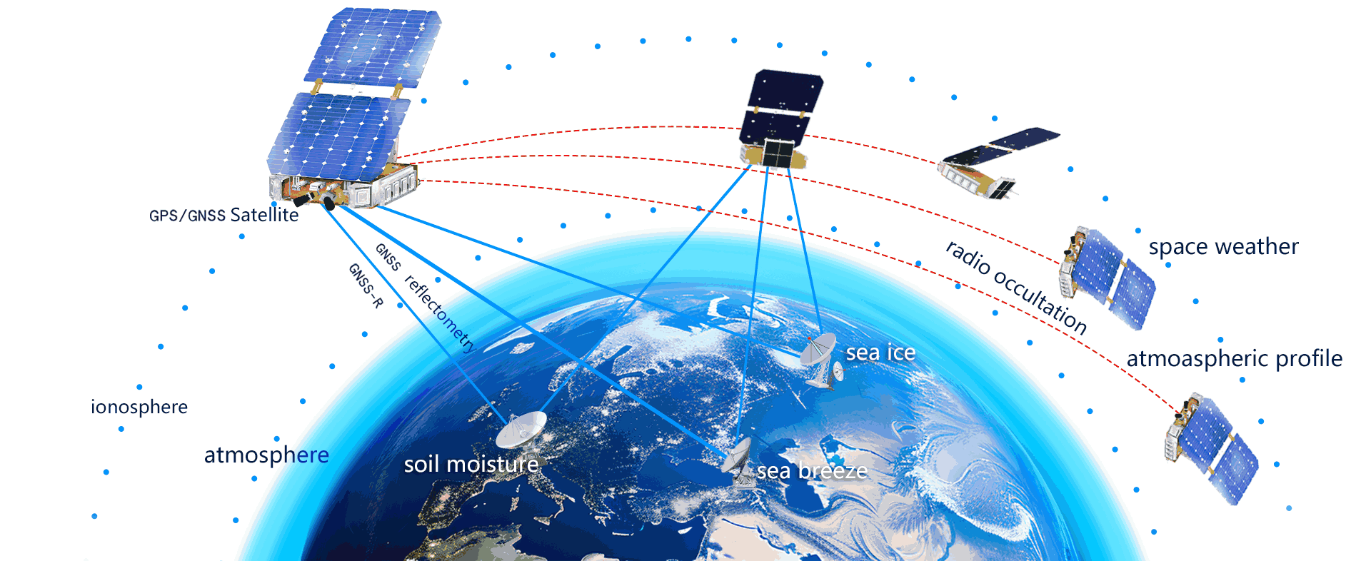
Data Acquisition
Tianmu 1 is equipped with "GNSS Occultation Reflection Detector" and "Atmospheric Density Detector", continuously collecting data on land, ocean, atmosphere, and ionosphere 24/7.


bias
std
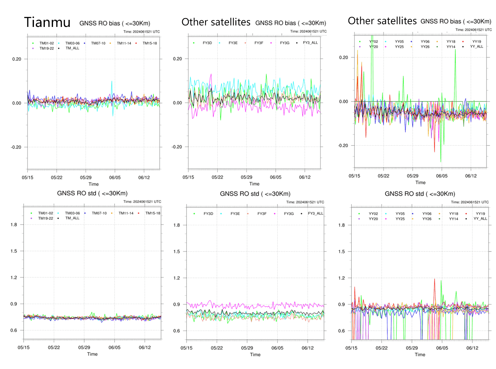
The China Meteorological Administration's assessment indicates that Tianmu occultation data offer higher accuracy, with smaller mean deviation and standard deviation compared to other occultation data.
Accuracy assessment of occultation data
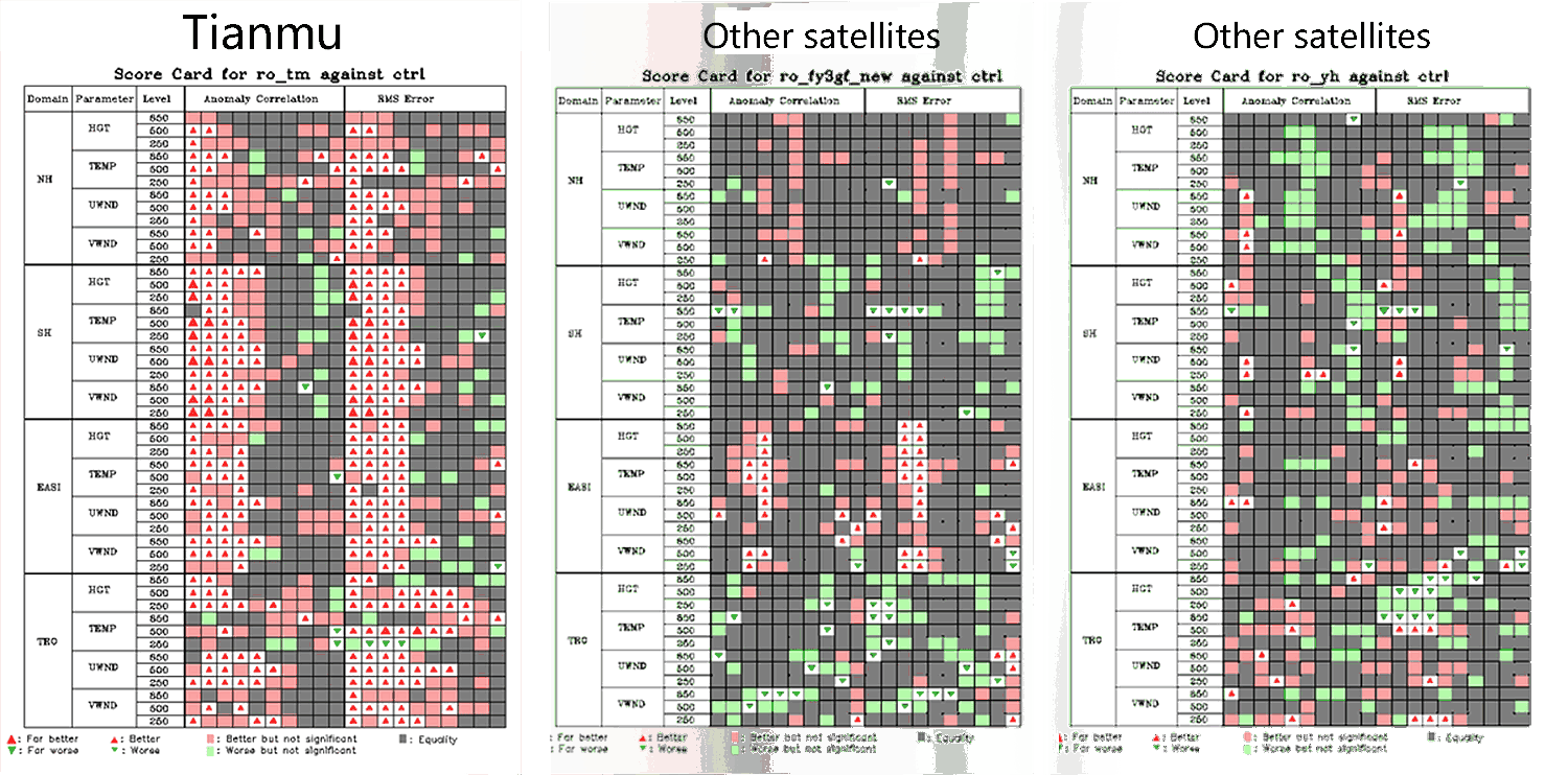
Forecast performance metric card
Legend: Red: Assimilated occultation data improved the forecast. Green: Assimilated occultation data worsened the forecast. Triangle size represents the magnitude of the effect.
Based on the forecast scorecard from the Numerical Prediction Center of the China Meteorological Administration, the assimilation of Tianmu occultation data into the CMA-GFS4.0 system has shown significant positive impacts on forecasts in all regions (Northern Hemisphere, Southern Hemisphere, East Asia, and the tropics), outperforming other occultation data sources.
Atmospheric Temperature, Humidity, and Pressure Profile
With limb scanning technique, we capture real-time atmospheric bending angles and refractive indices globally. Through inversion processing, it provides high-vertical-resolution, high-accuracy atmospheric profiles of temperature, humidity, and pressure.


Sea Ice Thickness and Coverage
Using GNSS reflection signal remote sensing, ice surface reflectivity and reflected power spectra are obtained based on the reflectance characteristics of GNSS signals from the ice surface, enabling the retrieval of global, all-weather, all-time sea ice thickness and coverage.


Atmospheric Density
The spatial and temporal distribution of atmospheric density at approximately 500 km in a sun-synchronous orbit enables the simultaneous retrieval of atmospheric density at different spatial locations at the same altitude. Level I products include sensor pressure and temperature information, while Level II products provide atmospheric density data at orbital altitude.
Orbital Atmospheric Composition
Spatiotemporal distribution of atmospheric constituents in a sun-synchronous orbit at an altitude of approximately 500 km, enabling simultaneous acquisition of atmospheric composition at the same altitude across different spatial locations.The Level I product consists of in-situ measurements along the satellite orbit, including the sampling chamber pressure and temperature for different neutral gas species, while the Level II product provides the along-track number density data of different neutral gas species derived from these observations.